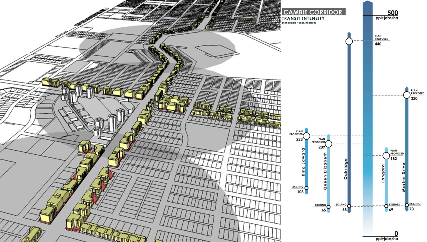
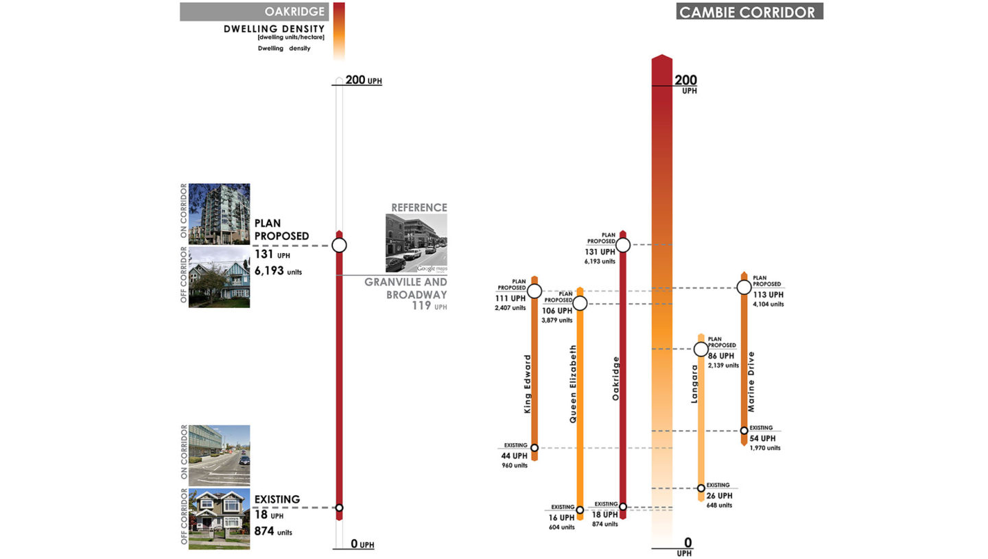
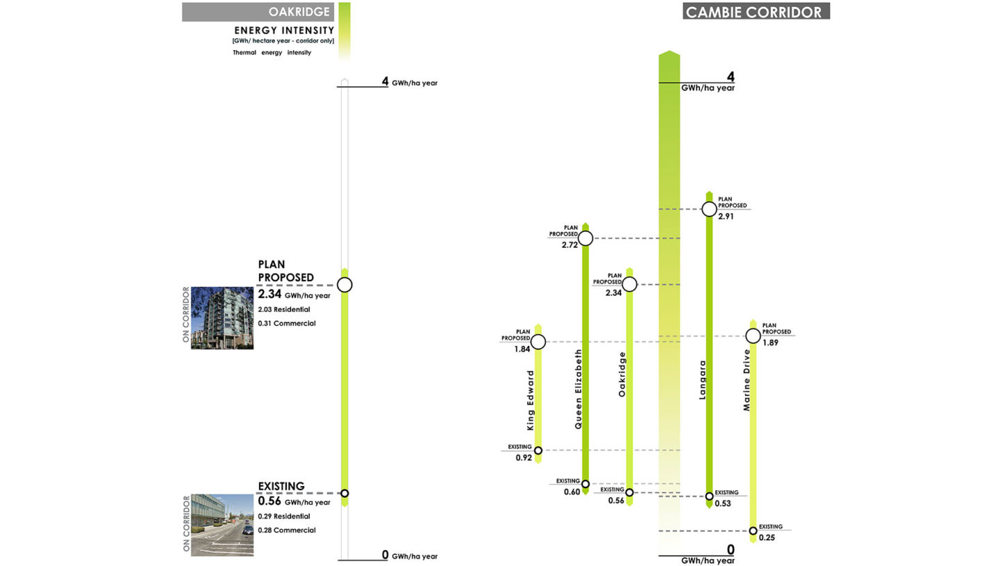
Cambie Corridor Measured Visualizations

elementslab created models and measured visualizations along the Cambie Corridor to help City of Vancouver staff, elected officials, and the public understand how the proposed Cambie Corridor Plan would change the area and help meet the city’s sustainability goals.

Project Profile

Sponsor
City of Vancouver

elementsLab Team
Cynthia Girling
Ronald Kellett
Elsa Snyder
Inna Olchovski
Eric Siu
Mike van der Laan
Phil Riley

City of Vancouver Team
Brent Toderian
Director Jim Bailey
Michelle McGuire
Matthew Roddis

In parallel with City-run public workshops and open houses to introduce the plan to the community, elementslab partnered with City of Vancouver staff to develop a digital model and metrics of proposed land uses, building types, densities and heights along the corridor. The information would help staff, elected officials and the public to understand what the redeveloped corridor would look like, if and how the proposed land uses and densities would support transit ridership, and where the proposed urban form changes would support community energy systems.

The results of our analysis demonstrated that the different land uses, densities and building heights proposed in sub-areas of the Plan would enable the corridor to grow into a chain of successful transit-oriented communities. Several sub-areas would have sufficient energy densities to support low carbon community energy systems. These results demonstrated that the city’s sustainability targets could be achieved with a diverse palette of building types, including high- mid- and low-rise forms.  The 3-d models from which these measurements were derived became the base for a series of illustrative aerial and streetscape images used by the city in public engagement.

More about this project