In Partnership with the City of Vancouver, this project tests machine-learning approach to future neighbourhood planning based on existing and future neighbourhood types.
Project Profile
Sponsor Social Sciences and Humanities Research Council (SSHRC)
Research Team Ronald Kellett Cynthia Girling Ruby Bernard Yuhao Bean Lu Nicholas Martino
City of Vancouver Collaborators Christopher Erdman Kari Dow Community Planning Division
This project tested a machine-learning approach for identification, analysis and comparison of existing and future-state neighbourhood types. The types were applied to a test study site using a rules-based approach to modification vs generated urban form and density. Select indicators from the City of Vancouver’s Resilient Neighbourhood Design Tool (RNDT) were used to evaluate physical design against resilience objectives.
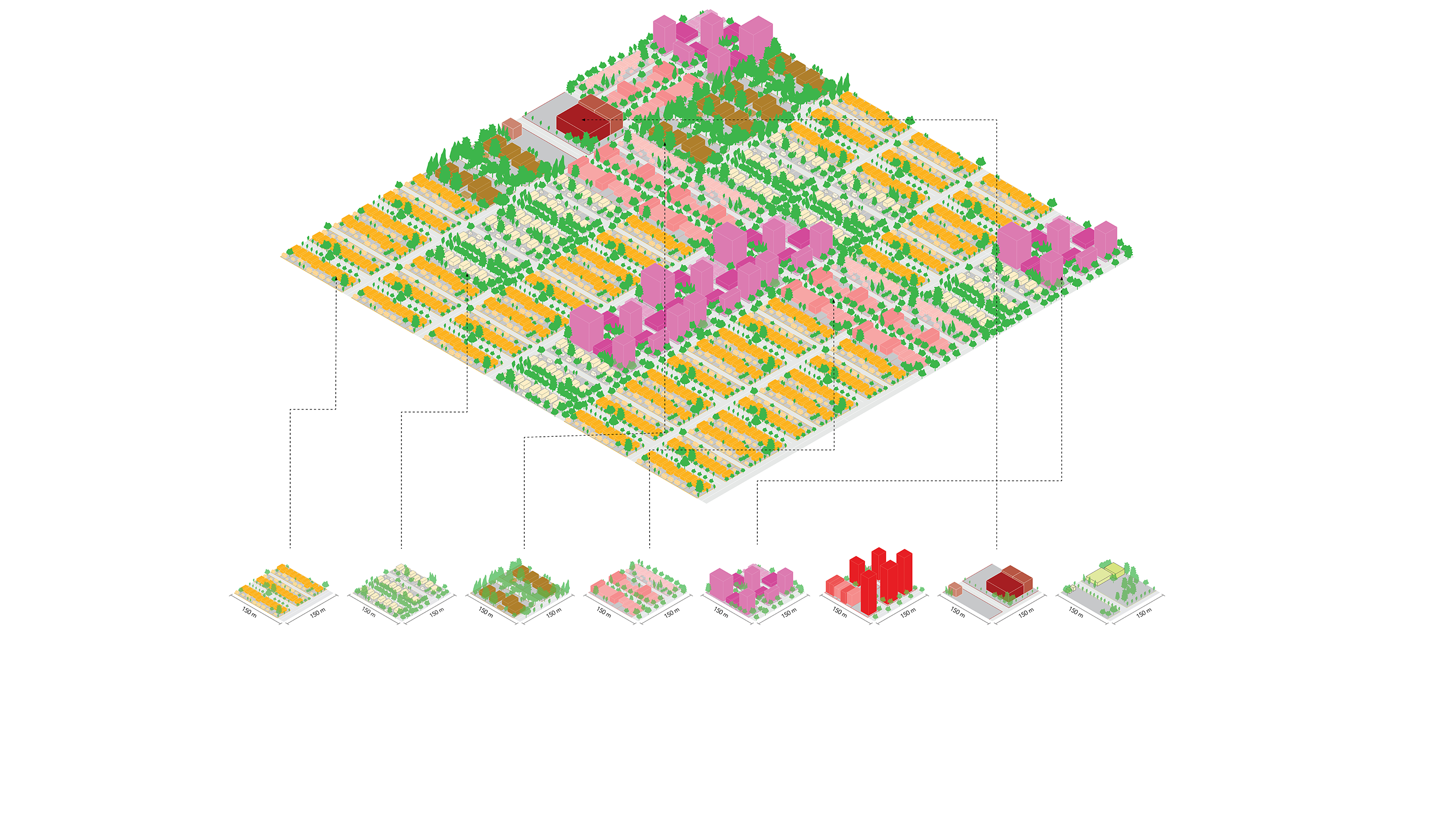
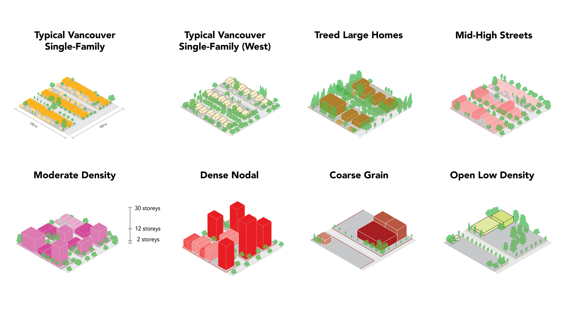
Eight urban form types — a representative set of neighbourhood scale typical patterns, based on physical characteristics were developed. The method utilizes primarily spatial data and a Gaussian Mixture Model (GMM), in a Geographic Information System (GIS). GMM is an unsupervised machine learning technique designed to probabilistically cluster data. It was trained on four facets of the City’s urban fabric: urban trees, street network, buildings, and parcels. This method generalizes and expedites the dynamic generation and measuring of urban form for rapid iteration of future what-if scenarios generated from the contemplated policy options. It includes data to enable comparative estimates of select indicators of urban resiliency- climate action, neighbourhood equity, built form, open space/amenities, housing mixes, and mobility.
Composite neighbourhood pattern using eight pattern types
Eight urban form neighbourhood pattern types found via machine-learning
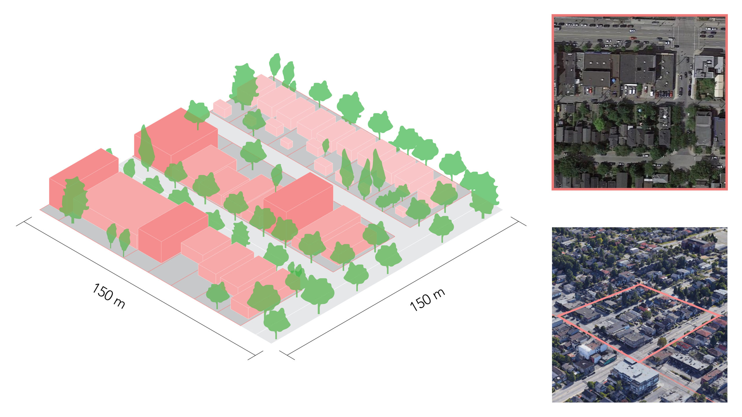
Building, block and street pattern of a Typical Vancouver Mid-High Street type


